BRGM is the result of two centuries of pioneering geological exploration and administrative developments. Although the first attempt at a geological survey map was made in 1746, it was not until 1868 that growing interest in extending our knowledge of the sub-surface and in its representation, led to the creation of the French geological mapping service. BRGM's direct predecessors were then set up from the Second World War onwards, before merging in 1959.
Although this was a rudimentary project, undertaken by Jean-Étienne Guettard, it marked the beginning of geological mapping in France. In 1746, this medical doctor, botanist and mineralogist published A mineralogical survey and map of the type and location of terrain underlying France and England. The legend on the map identifies three more or less concentric bands, stretching from the Paris basin to the south-east of England, as containing sand, marl or slate.
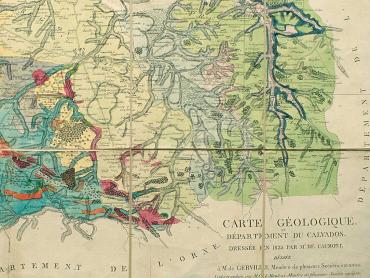
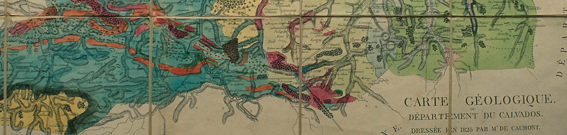
Geological survey maps improved significantly at the beginning of the 19th century. In 1816, Jean-Baptiste Julien d'Omalius d'Halloy made the Sketch of a geological map of the Paris basin and some neighbouring regions, at a scale of 1:800,000. In 1841, two young mining engineers, Armand Dufrenoy and Léonce Elie de Beaumont, produced the Geological Map of France, at a scale of 1:500,000, after ten years of work and 80,000 km of travelling on foot.
The French geological mapping service
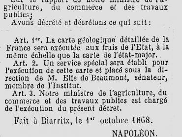
The 1867 Universal Exhibition, held in Paris, gave a real boost to the representation of the sub-surface: it presented 67 geological maps covering a vast area between Normandy and the Loire at a scale of 1:80,000. Following the success of this impressive wall panel and the recommendations of the Mining Administration, Napoleon III signed a decree on 1st October 1868 stipulating that "the detailed geological map of France would be produced at the State's expense" and that "a special organisation would be set up to do this". Thus was created the French geological mapping service, headed by Léonce Elie de Beaumont.
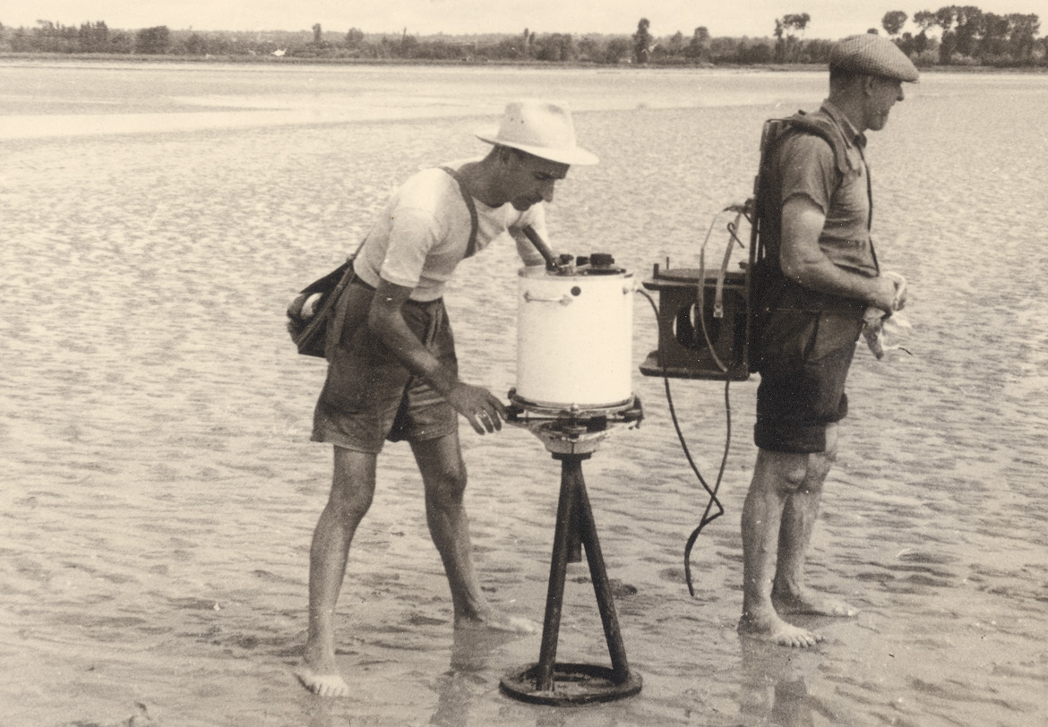
Between the two world wars, Edmond Friedel, a mining engineer, campaigned for the creation of an organisation to archive sub-surface data: the French geological and geophysical bureau (BRGG) opened in 1941 under his supervision. In 1953, it was replaced by the Bureau for geological, geophysical and mining research in mainland France (BRGGM), an industrial and commercial public institution that took over its geological and geophysical research role as well as the collection, archiving and dissemination to the public of documentation on sub-surface geology. The BRGGM was also authorised to acquire the mining rights necessary for its prospecting and exploitation activities and to invest as a shareholder in mining companies.
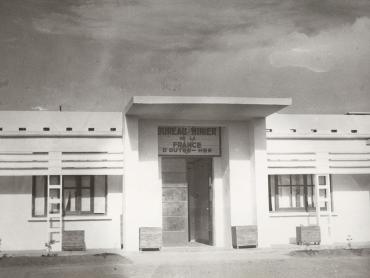
Mining offices at BRGM
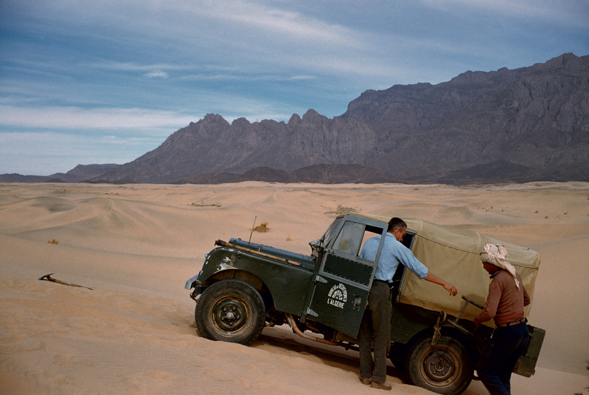
Meanwhile, France acquired mining offices in Algeria (BRMA) and overseas (Bumifom) in 1948, then in French Guiana (BMG) the following year. A major organisation covering the former French West Africa (AOF) and French Equatorial Africa (AEF) but also Madagascar and New Caledonia, Bumifom's know-how was gradually expanding and its workforce counted 2,173 employees at its peak in 1958.
That year marked a turning point in the national, European and international contexts. To adapt to this new world order, the geological research and mineral prospecting organisations were merged into a new public institution, including Bumifom, BRGGM, BRMA and BMG: the geological and mining research bureau (Bureau de recherches géologiques et minières - BRGM) was officially founded on 23 October 1959.