The early days of geological mapping
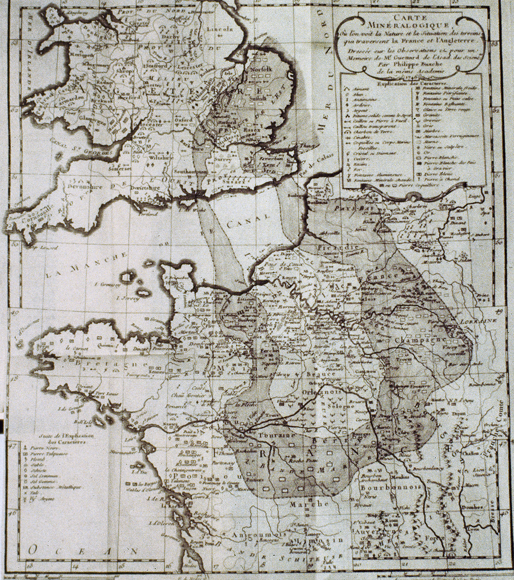
It is considered that the first attempt to make a geological map was proposed by Jean-Étienne Guettard in his book “Mémoire et carte minéralogique sur la nature et la situation des terrains qui traversent la France et l'Angleterre” (A mineralogical survey and map of the type and location of terrain underlying France & England) in 1746. It was not until the 19th century that the first major advances occurred with a sketch of a geological map of the Paris basin on a scale of 1:800,000 made by Jean-Baptiste Julien d'Omalius d'Halloy in 1816.
It all began in 1746, when Jean-Étienne Guettard, medical doctor, botanist and mineralogist, Réaumur's assistant and Lavoisier's friend, published a book entitled “Mémoire et carte minéralogique sur la nature et la situation des terrains qui traversent la France et l'Angleterre”. When presenting his thesis to the Royal Academy of Sciences on 19 February 1746, Guettard clarified his intention: “I proposed to show by this map that there is a certain regularity in the distribution of stones, metals and most other fossils”. In fact, on his map, in addition to the specific indications already mentioned, there are three more or less concentric “bands”, corresponding to “sandy, marly or slatey” soils that connect a large part of the Paris basin to the Kent, Middlesex and Norfolk regions in England, underneath the Channel and the Pas-de-Calais region. His was thus the first attempt at geological mapping, although still in a very clumsy and rudimentary way.
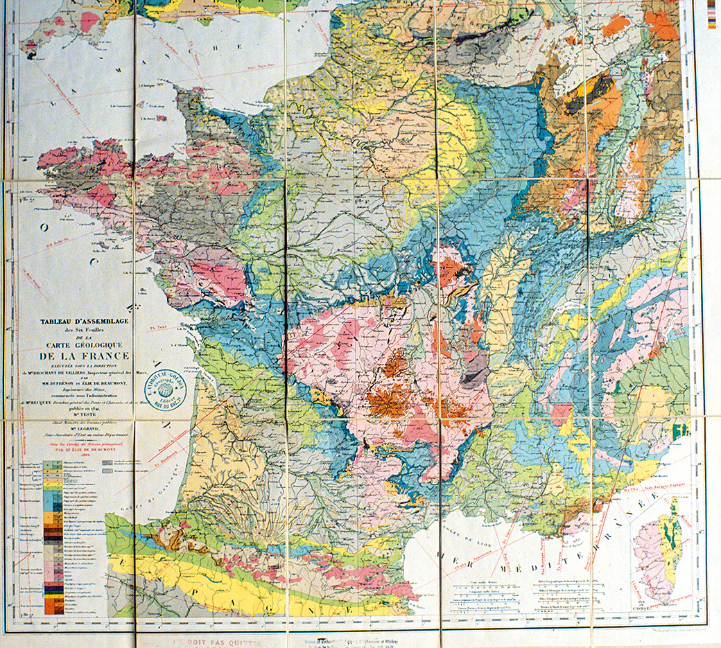
The first geological map of France at a scale of 1:500,000
The first significant progress was witnessed in the first half of the 19th century. In 1816, Jean-Baptiste Julien d'Omalius d'Halloy made the Esquisse d’une carte géologique du bassin de Paris et de quelques contrées voisines (Sketch of a geological map of the Paris basin and some neighbouring regions, at a scale of 1:800,000 - 1 cm represented 8 km). In 1841, two young mining engineers, Armand Dufrenoy and Léonce Elie de Beaumont, drew up the geological map of France on a scale of 1:500,000, the result of ten years of work during which they covered a distance of 80,000 km on foot.