20 years of monitoring the Aquitaine coast
The Aquitaine coast is subject to strong oceanic and anthropogenic stresses. The Government and the Nouvelle-Aquitaine Region therefore created the Observatoire de la Côte Aquitaine (OCA) in 1996 so that regional elected officials would have a decision-making tool for coastal management and development. For 20 years, the OCA has been closely monitoring developments on the Aquitaine coast.
More than 20 years ago, the Nouvelle-Aquitaine Region and the government created the Observatoire de la Côte Aquitaine (OCA), a unique, major environmental and scientific project in France, for coastal monitoring. BRGM was also the technical operator for the project and was rapidly joined by the French Forestry Commission (ONF). With the OCA, regional decision-makers (elected officials from local authorities and institutions, spatial planners and managers, etc.) now have a tool at their disposal to help them manage and develop the Aquitaine coast.
At the time, it was already necessary to take morphological coastline changes into account in the sustainable development strategies for coastal areas. To do this, it was important to take steps to improve knowledge of the coastline in order to be able to deal with the issues involved. For more than 20 years, under the guidance of the Government and the Region, with the participation of the Gironde, Landes and Pyrénées-Atlantiques départements, the Syndicat intercommunal du Bassin d'Arcachon, ERDF funds and with the scientific and technical support of BRGM and the ONF, OCA has been monitoring the coastline, developing technical innovation, increasing its range of expertise, collecting data, training experts and disseminating knowledge, to enable decision-makers to integrate coastline changes into their regional projects.
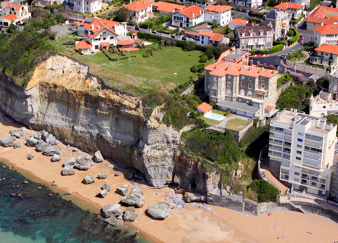
The stakes are high since the Aquitaine coast is greatly affected by erosion. On average, the sandy coast of Aquitaine is receding by 1 to 3 metres per year. Despite this, the Aquitaine coast, which is subject to strong oceanic and anthropogenic stresses due to demographics and tourism, must be able to accommodate the necessary infrastructure for its development and integrate it into sustainable development strategies.
The role of BRGM in OCA
BRGM has been acting as the technical consultant of the Observatoire de la Côte Aquitaine since its foundation in 1996 by carrying out various missions :
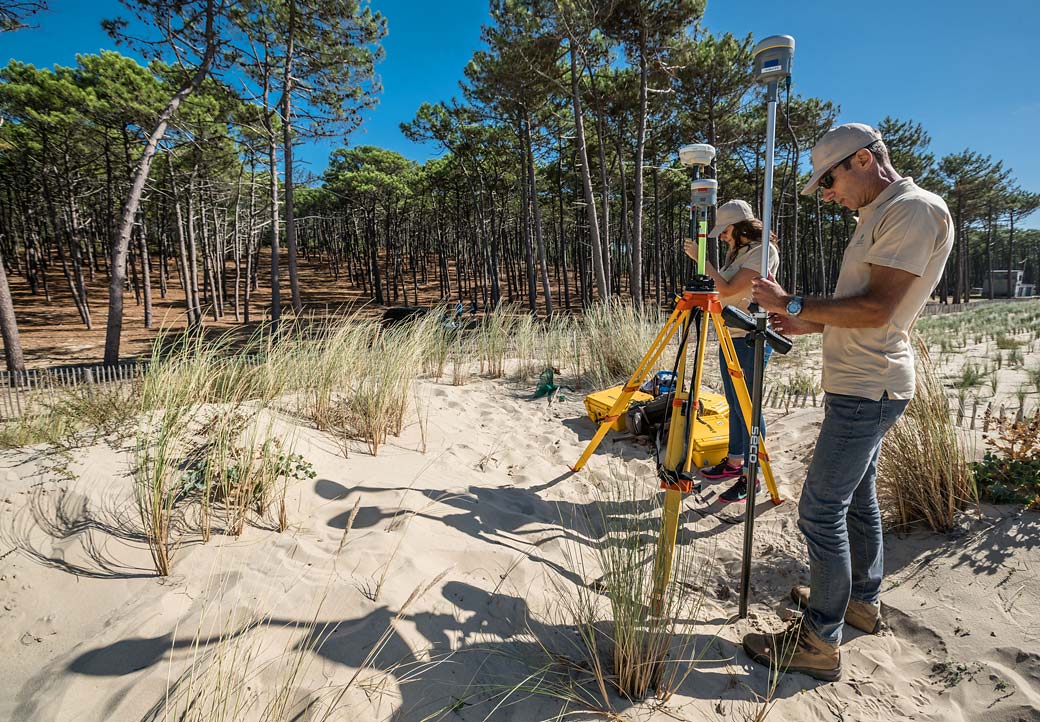
- to monitor geomorphological coastline changes (DGPS, satellite images, LiDAR, aerial photographs, photogrammetry, etc.);
- to learn more about sediment dynamics on the Aquitaine coast (displacement of sedimentary stocks, exchanges between compartments in littoral cells, etc.);
- to predict the retreat of the shoreline based on the data collected and knowledge acquired by making shoreline projections for 2025 and 2050 and assessing impacts due to climate change and extreme events (storms) etc.;
- to provide expertise and recommendations for local authorities;
- to manage the Observatory's resource centre;
- to promote the Observatory's work by communicating with managers and the general public (through a website, conferences, communication media, educational actions, etc.).